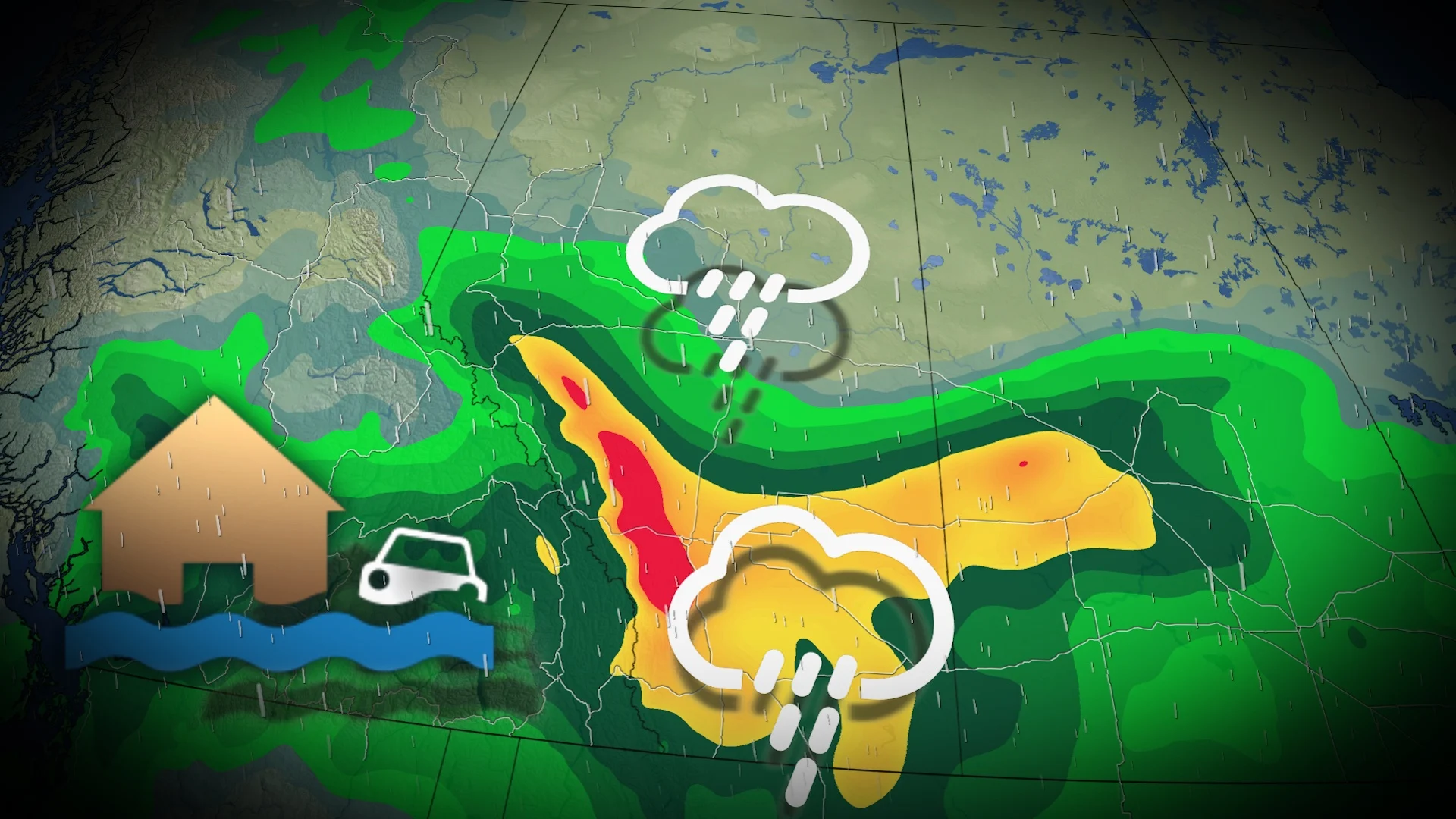
Flood risk rises on the western Prairies with 50-100+ mm of drenching rains
An atmospheric combination of an upper-level trough, surface low, high atmospheric moisture and southeasterly winds will lead to rainfall totals exceeding 100 mm for parts of the Prairies.
Soaking rains that arrived on the western Prairies on Friday will continue into the beginning of the weekend as a broad trough swings over the region.
DON’T MISS: Weather pattern flips hit Canada's summer for July and August
Localized flooding is possible in parts of Alberta and Saskatchewan. Some areas in Alberta could see 100+ mm of precipitation through Monday morning.
If that wasn't a big enough story, parts of the Rockies are even looking at some accumulating snowfall this weekend.
Rainy weekend expected for the Prairies
We can expect this precipitation to increase in intensity heading into the day Saturday.
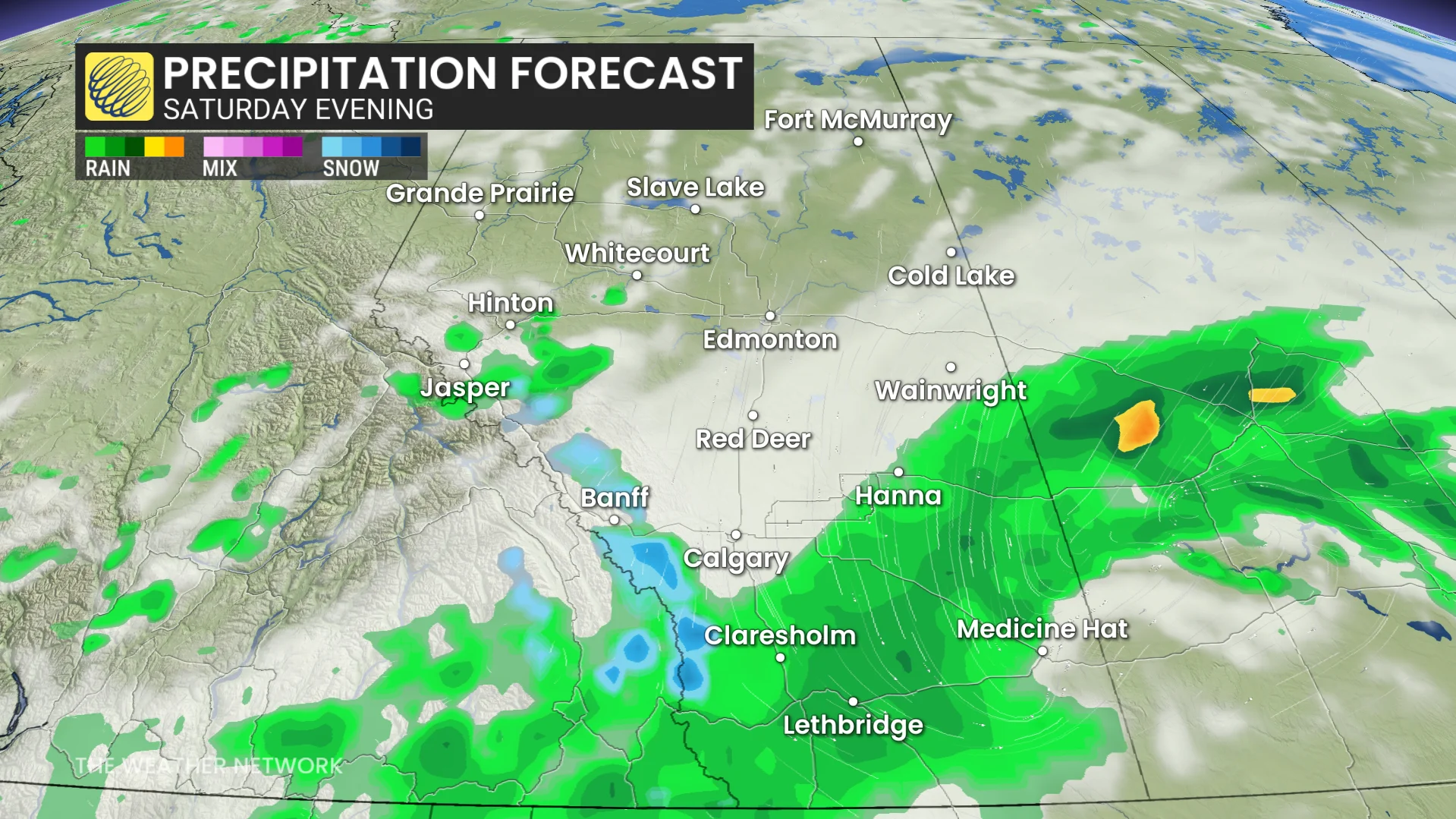
The heart of the precipitation will push east into Saskatchewan overnight Saturday and into Sunday as the trough moves east.
Folks throughout the region will see formidable rainfall totals from this event.
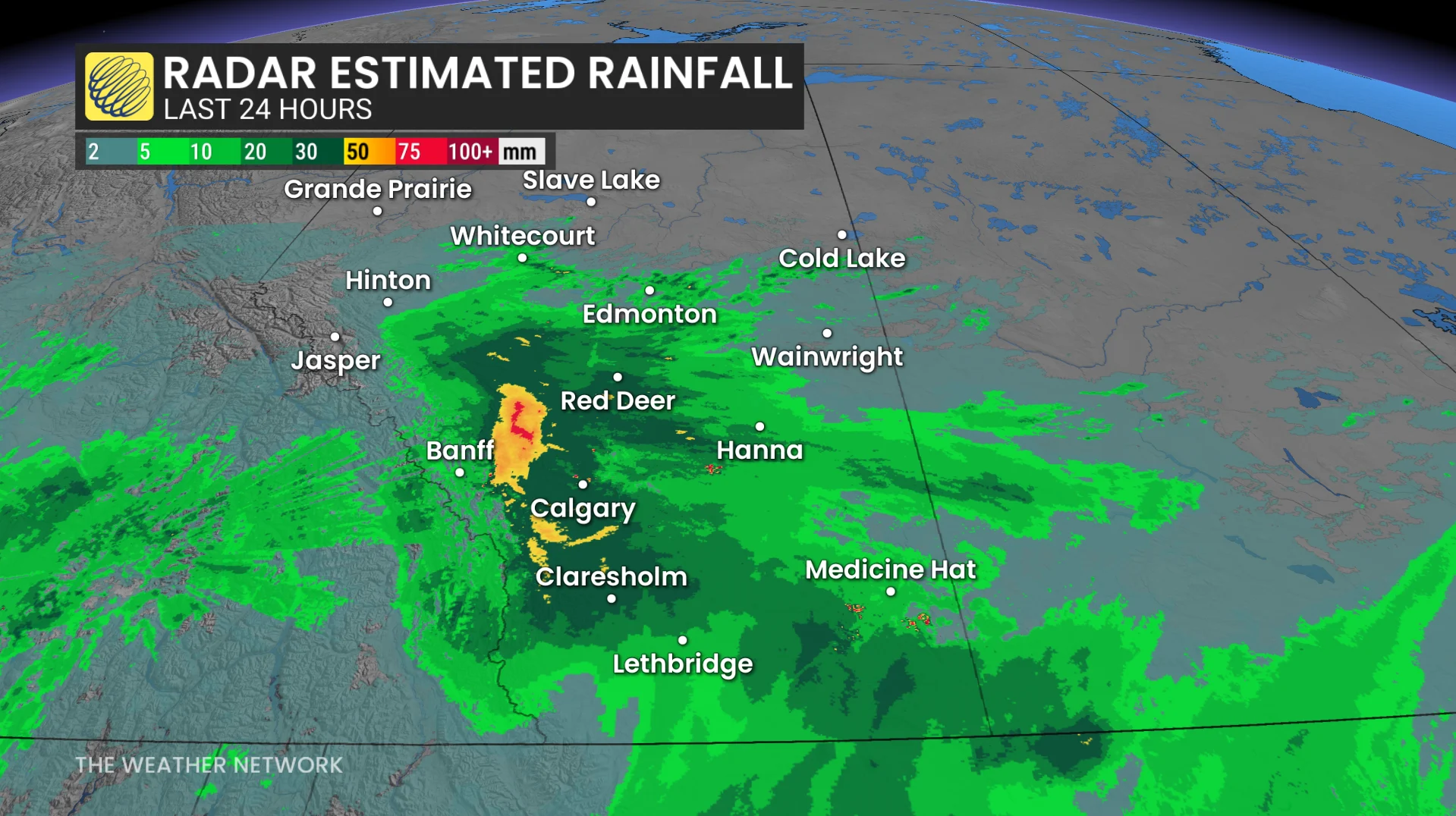
A widespread swath of 50-100 mm will cover southern Alberta—mainly concentrated on the foothills, including Calgary—with some communities potentially seeing more than 100 mm of precipitation. Some accumulating snow is even possible in the mountains.
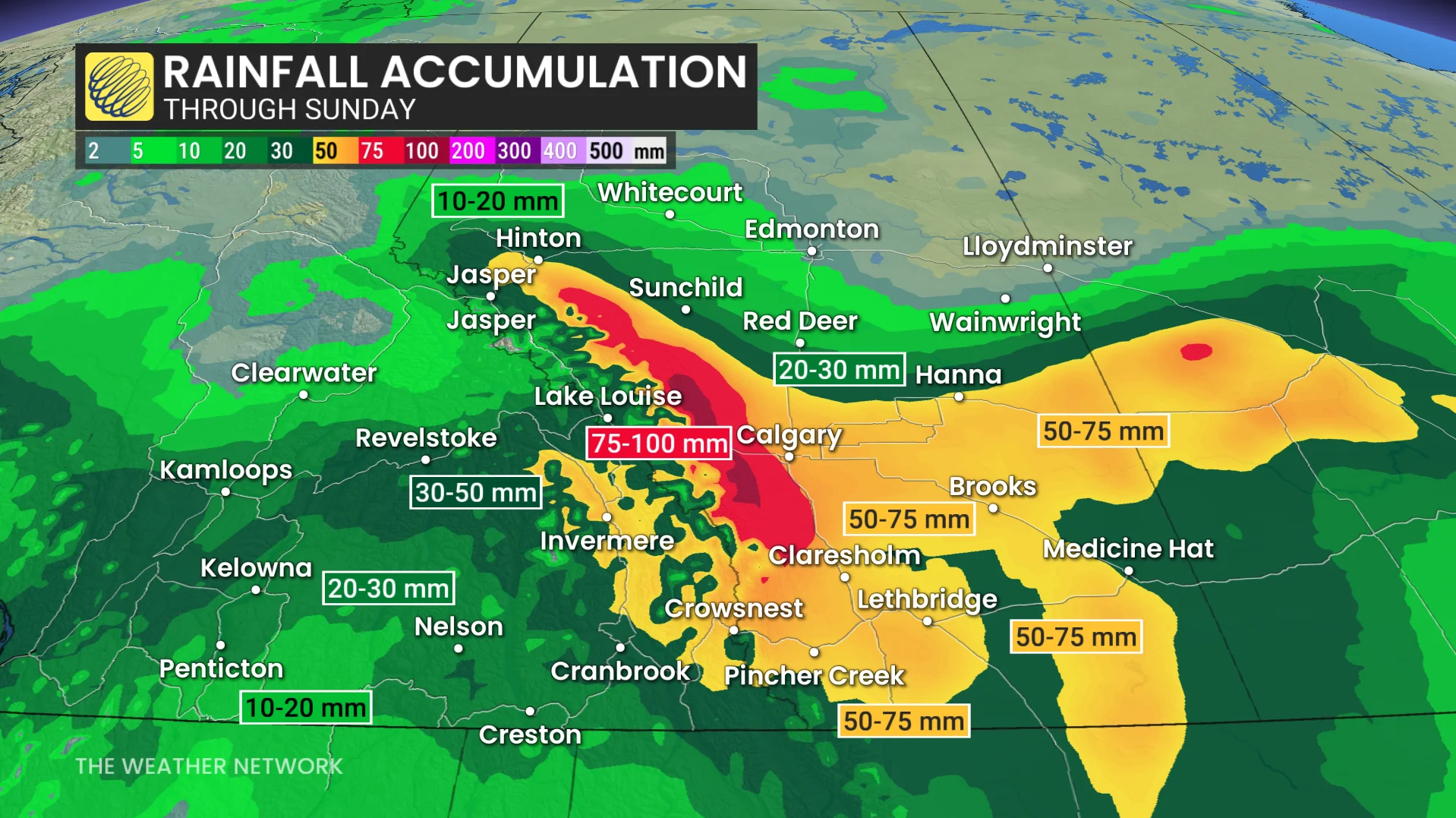
30-50 mm of rain is on the way for much of southern Saskatchewan, with southwestern communities near Swift Current and Kindersley expecting 50-75 mm in the gauges through Monday.
WATCH BELOW: Heavy rain forecast marks 2013 flood anniversary, will it be a repeat?
Many are concerned that this will rival the 2013 flood in southern Alberta, when 50-90+ mm fell across the region. During the event from June 19-21, 76 mm fell in Calgary, while Banff picked up 92 mm.
Although rainfall amounts are expected to be similar, and even higher in some locations, one of the main differences is the amount of snowpack in the mountains.
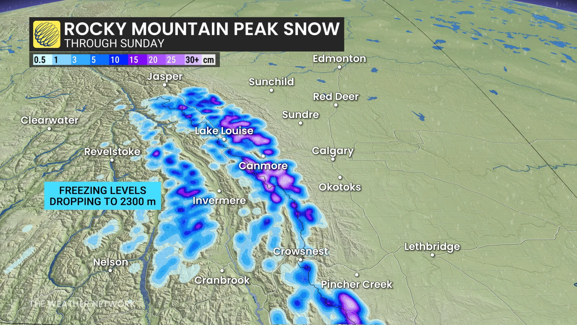
At the Little Elbow Summit, there is currently around 5 mm of snow-water equivalent, whereas in 2013 it was sitting around 150 mm. That snowmelt enhanced the amount of water going into the river shed, which then helped to cause the widespread flooding of 2013.
June rain is welcomed news for summer wildfires
Rain in June is good news for both agricultural interests across the Prairies as well as building some natural protection ahead of the heart of wildfire season this summer.
Beware the risk for localized flooding across areas that experience persistent heavy rainfall. Remember, never try to drive across a flooded roadway. It’s impossible to tell how deep the water is until it’s too late.
SEE ALSO: 2 people now confirmed dead in Bow Glacier Falls rockfall in Banff National Park
We’re also watching the potential for gusty winds to buffet some of the affected areas through the day Saturday. Downed trees and power lines are possible as heavy rain saturates the ground.
WATCH: Know the difference between a watch and a warning this severe weather season
Thumbnail courtesy of Unsplash.